We have compiled a list of manufacturers, distributors, product information, reference prices, and rankings for Disaster Information Visualization System.
ipros is IPROS GMS ・ IPROS One of the largest technical database sites in Japan that collects information on.

Disaster Information Visualization System - List of Manufacturers, Suppliers, Companies and Products | IPROS GMS

Disaster Information Visualization System Product List

1~2 item / All 2 items

Displayed results

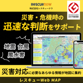
Rescue Web MAP | Consolidating managed properties, facilities, and risks on a map

Consolidate disaster and crisis information around managed buildings and facilities onto a single map! You can see at a glance which properties and facilities are affected.

Real estate and facility management that directly connects to the risks of power outages, water supply interruptions, and flooding for residents and tenants. Even if the building is intact, power outages or water supply interruptions may halt elevators and water supply and drainage systems, making quick verification of lifelines essential. However, it is difficult to grasp the situation of widely scattered managed properties manually, and delays in information gathering can directly lead to delays in response. With "Rescue Web MAP," you can quickly check on a map which properties or facilities are affected when a disaster occurs. By reducing the effort of gathering information and cross-referencing with each property, it supports faster decision-making related to initial responses, such as prioritizing inspections and determining the need for immediate action. 【Features】 - Alerts via email about disaster and crisis occurrence information. Also addresses "lifeline information" such as power outages and water supply interruptions. - Centralized understanding of risks such as river flooding and inundation. Useful for checking properties with underground facilities. - Displays hazard maps such as flood inundation risk areas, also useful for confirming property risks during normal times. - Automatically extracts properties in disaster-affected areas, available for download in Excel format. *For more details, please refer to the PDF document or feel free to contact us.

  • Other services
  • Disaster Information Visualization System

Added to bookmarks

Bookmarks list

Bookmark has been removed

Bookmarks list

You can't add any more bookmarks

By registering as a member, you can increase the number of bookmarks you can save and organize them with labels.

Free membership registration

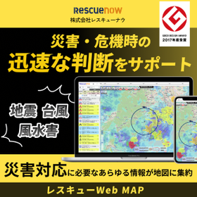
Rescue Web MAP | Consolidating bases, agencies, and risks on a map

Consolidate disaster and crisis information around your company locations and agencies onto a single map! You can see the overall damage and the affected locations at a glance.

In the event of a large-scale disaster, the insurance industry is required to respond to a large number of claims in a short period of time. If the overall picture of the damage cannot be grasped, the initiation of damage investigations and payment systems will be delayed, making it essential to understand the situation immediately after the disaster occurs. However, it is difficult to manually grasp the conditions of widely scattered bases and agencies, and delays in information gathering can directly lead to delays in response. With "Rescue Web MAP," when a disaster occurs, you can quickly check on a map which bases or agencies are affected. By reducing the effort required to gather information and cross-reference it with each base, it supports the acceleration of decision-making related to the establishment of a response headquarters and the allocation of personnel for damage investigations. **Features** - Alerts via email for disaster and crisis occurrence information. Monitored by personnel 24/7. - For earthquakes of magnitude 5 or higher, the first report on the damage situation is provided 60 minutes after occurrence, and the second report 120 minutes later. - Visualizes the operational status of infrastructure (roads, electricity, water supply, communication) to confirm its impact on local response. - Automatically extracts bases and agencies in the disaster-affected area, available for download in Excel format. *For more details, please refer to the PDF document or feel free to contact us.*

  • Other services
  • Disaster Information Visualization System

Added to bookmarks

Bookmarks list

Bookmark has been removed

Bookmarks list

You can't add any more bookmarks

By registering as a member, you can increase the number of bookmarks you can save and organize them with labels.

Free membership registration

Related Categories of Disaster Information Visualization System